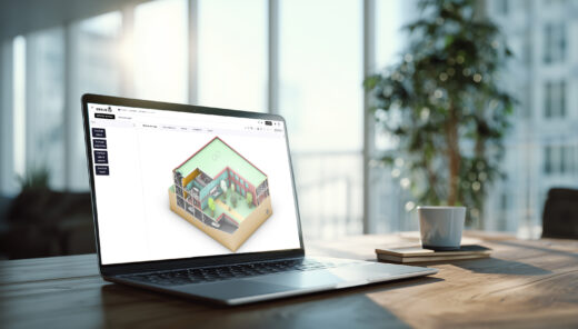
GIS Portal: centralised and accessible geographic data
At Sweco, we are fully committed to digitalisation that offers concrete added value for our projects and clients. The Geographic Information System (GIS) portal is a striking example. This tool centralises geographical data on a single digital platform, allowing everyone – from project staff to clients – easy access to essential information.

What does the GIS portal do?
The GIS portal is an online environment where geographical information – e.g. maps, project zones, contours, or spatial datasets – is displayed clearly and interactively. No matter whether it is internal data or information within the framework of a concrete project: everything becomes visually represented, clear, and easily shareable.
Importantly, you don’t need to be a GIS expert to work with it. The portal is designed so that even non-technical users can easily access or even modify the data, both within Sweco and externally with clients and stakeholders.
A key role in projects
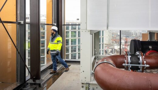
Currently, the GIS portal is mainly used in projects for public authorities and utilities, such as Flemish Waterways plc and Fluxys. But this kind of portal even plays a key role in large-scale infrastructure projects, such as Oosterweel and the R0. We often see that once it has been successfully deployed, clients expect it for subsequent projects as well.
A central digital hub
GIS data was previously mainly used locally on desktops. That made cooperation difficult. With the GIS portal, we are moving to a shared platform in the cloud. This increases efficiency, enables real-time collaboration, and ensures that information is always up to date. Moreover, we increasingly use the portal in meetings or participation moments with citizens.
Technology and platform
The basis of the GIS portal is ArcGIS Enterprise. This technology allows us to add interactive applications, such as surveys and comments via map locations, in addition to the maps. Although currently mainly a visualisation and collaboration tool, it is being explored to link it to other digital technologies.
Benefits for collaboration and sustainability
The tool provides a more interactive way of working and encourages collaboration between internal teams and external partners. By pooling data centrally, redundant communication rounds disappear and no one has to create maps over and over again. This saves time and resources, and provides a sustainable benefit.
In addition, based on the data collected, we can perform analyses, detect trends, and provide more targeted advice. Data monitoring and reporting via dashboards are also among the options. Thus, the GIS portal contributes to a more thoughtful and efficient project progress.
Future developments and ideas
The GIS portal is constantly evolving. There are plans to standardise project portals more and work with templates so that we can move faster on new projects. We also want to offer the tool as Software as a Service to clients, allowing them to access their own data independently.
Internally, we are looking at how different portals – such as for tenders or project contours – can be better aligned. Over time, this may lead to a more integrated digital ecosystem within Sweco.

Els Creemers