Sweco Belgium
The 2021 floods: five years later, the foundations for a resilient transition
In July 2021, exceptionally severe floods struck the Vesdre and Ourthe valleys, leaving a lasting mark on many Walloon municipalities. Beyond the human and material damage, the event revealed the structural vulnerability of valley-floor territories to the increasing intensity of extreme climate events. It also highlighted the urgent need to fundamentally rethink spatial planning approaches.
To respond to these challenges, the Public Service of Wallonia (SPW) launched a framework agreement in July 2022 to provide urban planning and hydraulic support to the municipalities most severely affected. The ambition was clear: not simply to rebuild, but to turn this crisis into a starting point for a sustainable, coherent and resilient territorial transformation.
In this context, Sweco was commissioned to support the municipalities of Liège, Verviers, Trooz, Rendeux and La Roche-en-Ardenne. The team mobilised complementary expertise in urban planning, hydrology, ecology, landscape, mobility and infrastructure, with support from IDEA Consult for the economic, financial and governance aspects.
The first publications dedicated to the project highlighted the foundations of this approach: territorial and hydraulic diagnostics carried out at several scales, the identification of redevelopment pathways, and the design of reconstruction schemes and structured project sheets. These tools enabled municipalities to prioritise their actions, launch new operational contracts and embed local interventions within an overall valley-scale vision.
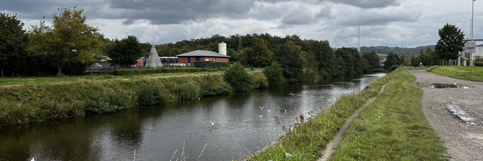
Affected municipalities: Sweco’s urban planning support to strengthen resilience
The ‘Urban planning support for affected municipalities’ project aimed primarily to strengthen the resilience of Walloon municipalities impacted by the 2021 floods by integrating water risk as a structuring element of spatial planning. It supported local authorities in redefining the future of valley-floor areas, protecting communities and transforming public spaces.
Sweco’s role was to provide strategic and operational support, structured around three complementary pillars:
- carrying out in-depth diagnostics covering the local causes of flooding, hydrological functioning, soil characteristics, urban uses and environmental challenges;
- issuing detailed recommendations on hydraulic, urban planning, technical and architectural options to be considered in the short, medium and long term;
- developing reconstruction schemes and operational sheets for structuring projects, designed as tools that municipalities can use directly.
The study areas covered diverse but interconnected contexts:
- Liège: the districts of Angleur and Chênée, at the Vesdre–Ourthe confluence;
- Verviers: the Mangombroux catchment, a tributary of the Vesdre;
- Trooz: the Magne and Ry de Vaux catchments, tributaries of the Vesdre;
- Rendeux: the valley floor and slopes of the Ourthe;
- La Roche-en-Ardenne: the valley floor and slopes of the Ourthe.
Sweco’s approach was based on a systemic reading of the territory, connecting the dynamics of water, soil and living systems. It made it possible to promote nature-based solutions, complementing existing infrastructure, to slow runoff, encourage infiltration and give more space back to rivers.
- Luik: de wijken Angleur en Chênée, aan de samenvloeiing van Vesder en Ourthe;
- Verviers: het stroomgebied van de Mangombroux, een zijrivier van de Vesder;
- Trooz: de stroomgebieden van de Magne en de Ry de Vaux, zijrivieren van de Vesder;
- Rendeux: de vallei en hellingen van de Ourthe;
- La Roche-en-Ardenne: de vallei en hellingen van de Ourthe.
De aanpak van Sweco vertrok vanuit een systemische lezing van het territorium, waarbij de dynamieken van water, bodem en natuur met elkaar werden verbonden. Zo konden nature-based solutions worden voorgesteld als aanvulling op bestaande infrastructuur, met als doel de afstroming te vertragen, infiltratie te bevorderen en waterlopen opnieuw meer ruimte te geven.
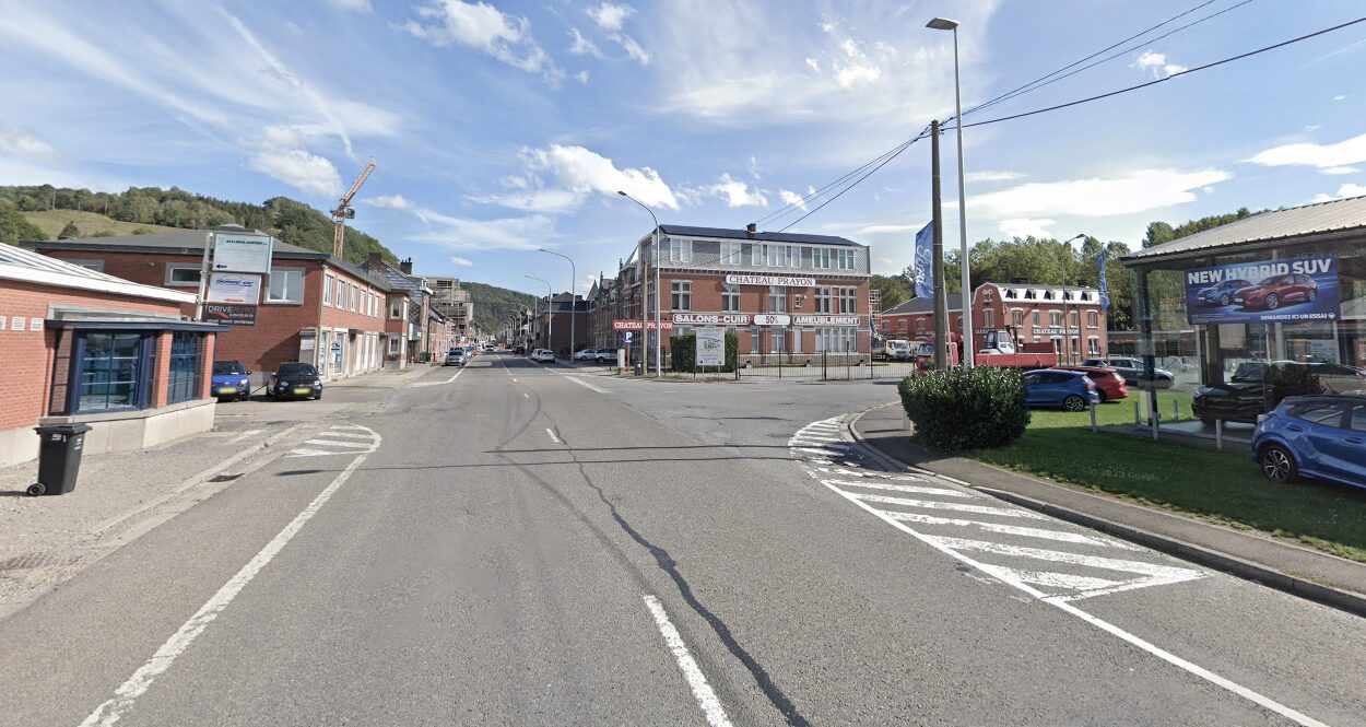

Five years after the floods: from strategy to action on the ground
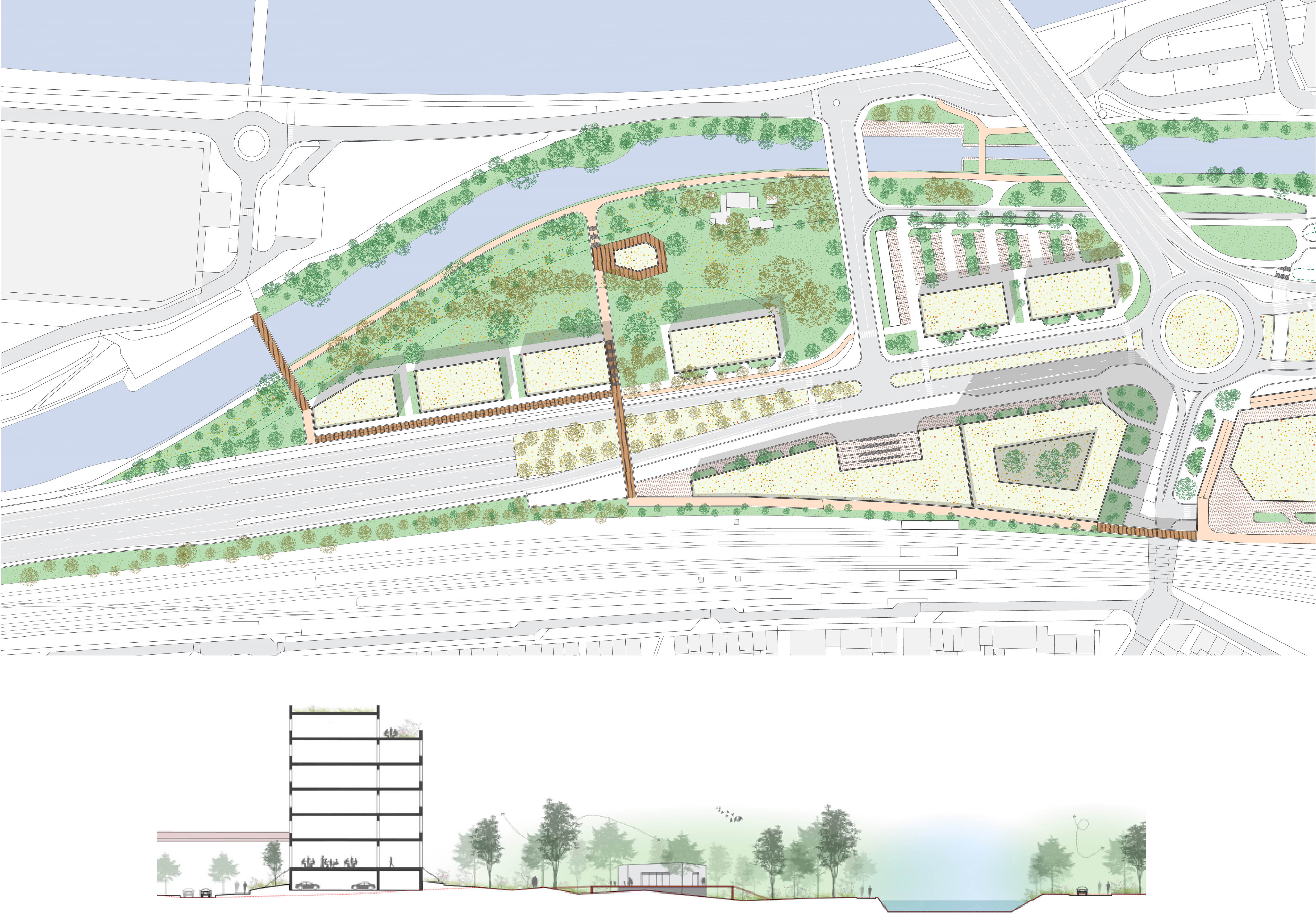
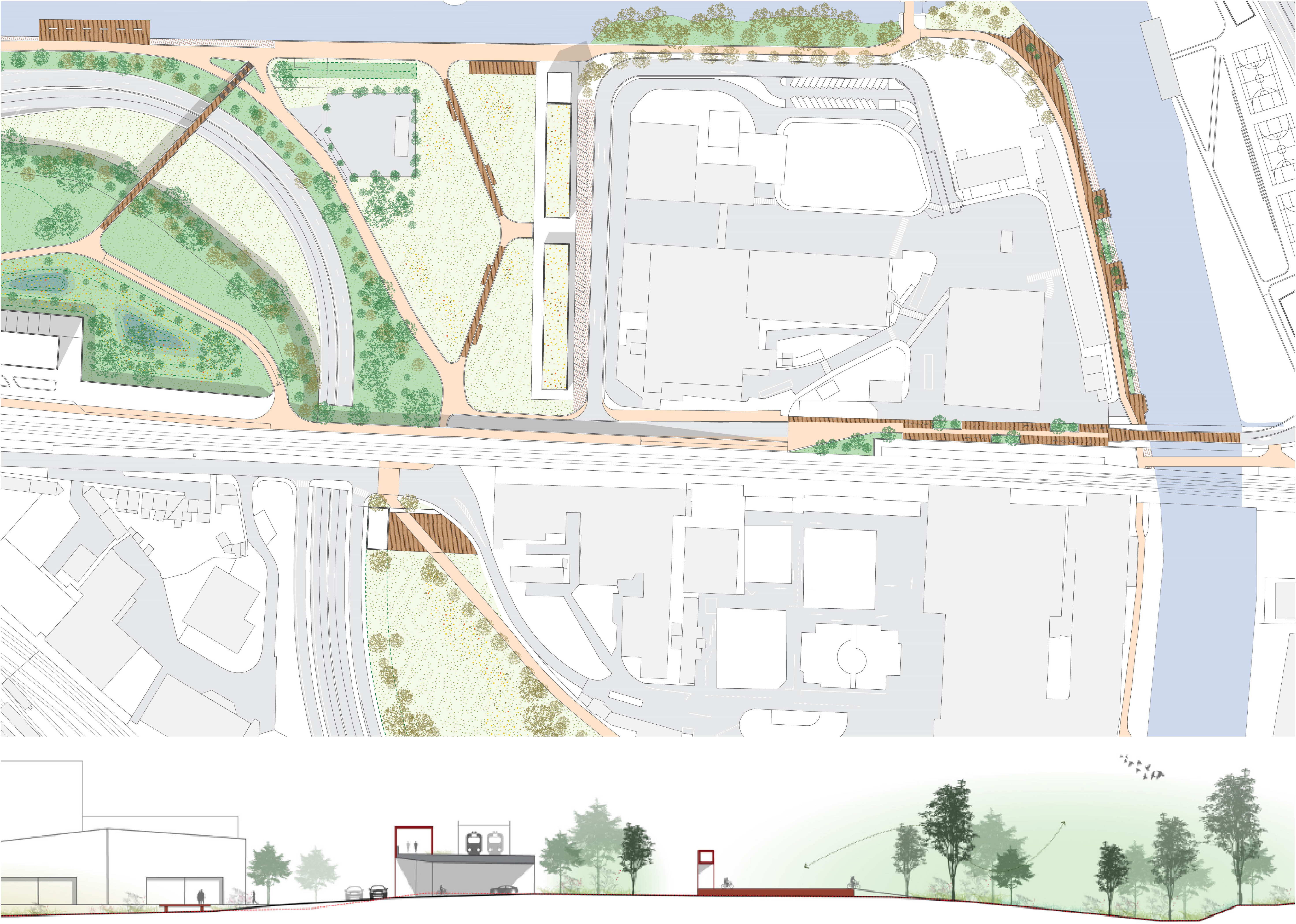
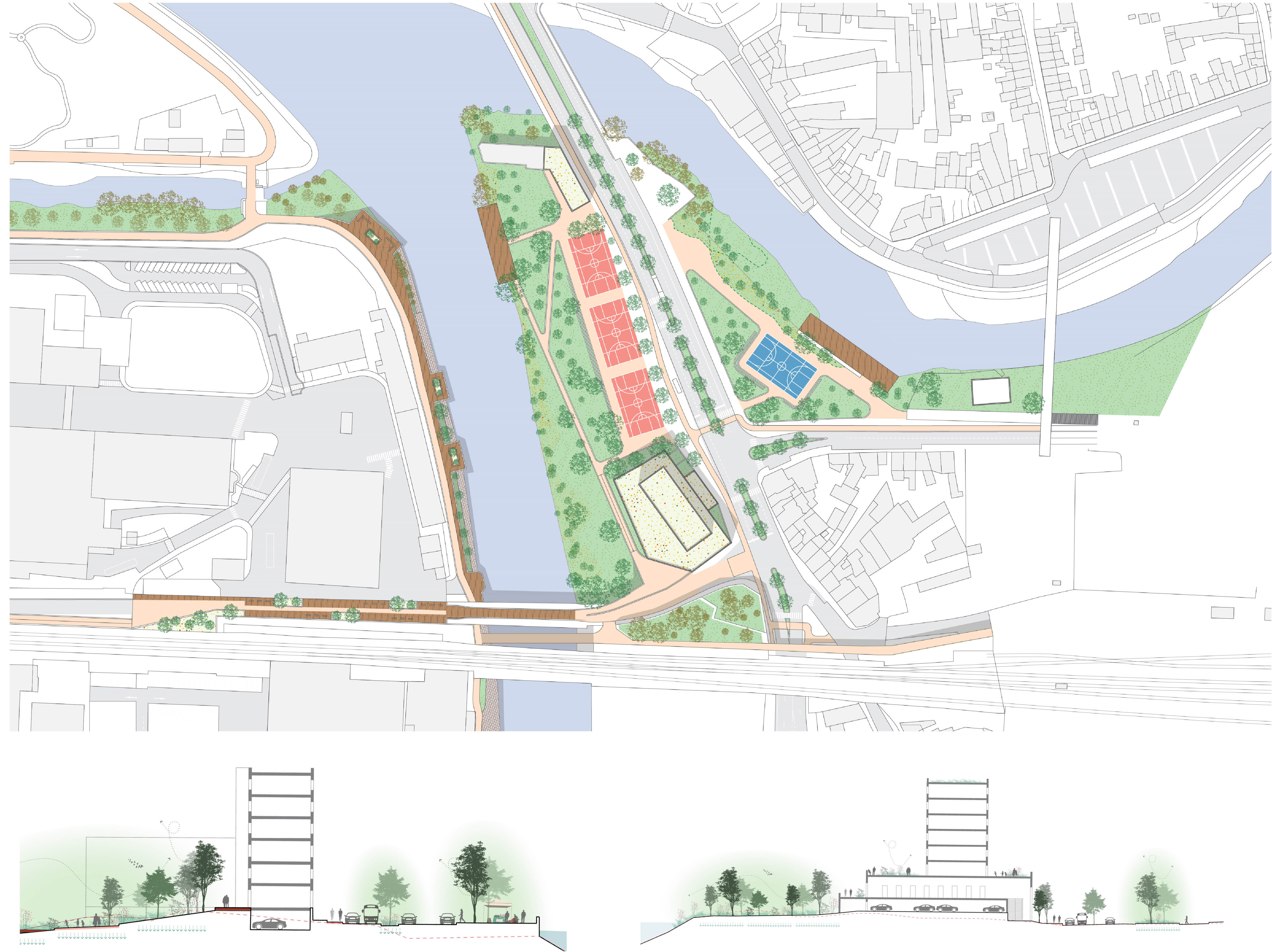
In 2026, the impact of the various studies carried out across the territory is gradually translating into concrete achievements. In Liège, on the Angleur and Chênée sites, an operational masterplan is currently under way at the Vesdre–Ourthe confluence. The reflections developed through the urban planning support helped deepen the issues of risk management, urban regeneration and adapted land use, and now serve as a basis for operational projects.
At the same time, SPI is leading a series of projects to redevelop resilient riverbanks across the catchment area. Sweco is actively involved through two framework agreements, mobilising its infrastructure and hydrology engineers. These projects give concrete form to the recommendations from the preliminary studies: depaving, strengthening ecological continuity, adapting riverbanks to floods and integrating uses into spaces that can accommodate water.
The operational implementation of the recommendations developed through the urban planning support is therefore continuing progressively, marking an essential shift from diagnosis to action.
Building on experience: a strategic scheme for the Ourthe catchment
Building on this field experience, Sweco was entrusted with developing the strategic scheme for the Ourthe catchment, a territory also severely affected by the 2021 floods. This assignment follows on from the strategic scheme developed for the Vesdre and is aligned with the municipal development schemes required by Wallonia’s Spatial Development Plan.
For this assignment, Sweco is working with a tailored multidisciplinary team, bringing together Vraiment Vraiment, IDEA Consult, Louise Rivière, Natagriwal ASBL, écorce and Charlène Descollonges, as well as Sweco’s in-house expertise in spatial planning, hydrology, ecology and biodiversity, landscape and climate mitigation.
🧭 Our mission
- Developing a thorough understanding of the territory in order to act effectively.
- Making territories more resilient: slowing, distributing and infiltrating water flows.
- Establishing a shared working framework for a common strategic tool.
- Promoting active and inclusive governance.
🌡️ Climate challenges
- Integrated risk management in the context of global change.
- Building a resilient, low-carbon transition.
⛰️ Soil challenges
- Differentiated water management at the scale of the Ourthe River basin.
- Aligning spatial planning with soil quality objectives.
- Using soil as a lever for water resilience.
💧 Water challenges
- Integrated water management at the watershed scale.
- Spatial planning and water resilience as guiding principles for action.
🦦 Biodiversity and living environment challenges
- Understanding the interactions between habitats, wildlife and water management.
- Striking a balance between the environment, mobility and the ecological network.
Climate, soil, water and biodiversity challenges are addressed in an integrated manner, positioning soil and natural systems as key drivers of the transition. This work represents a major opportunity to co-create an ambitious and coherent vision for the Ourthe and its valleys, while embedding the lessons learned from the 2021 floods into long-term climate strategies and nature-positive solutions.
Other News

The parking ladder: take control of parking policy, one step at a time
Read more

Approved by children: designing safe school environments
Read more

More eyes at sea: Sweco designs offshore platform concept for marine monitoring and enforcement in the North Sea
Read more